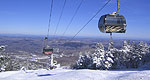
Ski resorts set the scene for the mountains around the town of Killington in winter, though venture to these parts outside of peak season and find also pleasant hiking trails, well-groomed golf greens and a handful of rural attractions.
The Brook Trail with its steep ledges is
more difficult than the Liberty Trail. It has
excellent views on the rocky ledges near the
summit of Mt. Chocoura. The trail can be
hazardous in wet or icy conditions. The trail
begins by following a gravel road beyond the
parking lot gate. The trail leaves he gravel
road on the right at .4-mile and follows south
of Claybank Brook. The trail passes to the
junction with the Bickford Path and
continues to the first ledge at 3.0 miles near
where the new Beeline relocation enters on
the left. The trail climbs the steep, open
ledges of the Farlow Ridge with Cairns and
yellow blazes to mark the way. The Liberty
Trail enters from the right at 3.4 miles with
the summit of Mt. Chocoura another .2 miles
via the Brook Trail.
Details
Additional Details:
Brook Trail: Distance from the Paugus Mill
parking area to the Claybank Brook
Crossing: 2.5 miles, 1 hour and 40 minutes.
We offer a compact version of Go-Vermont for mobile users, allowing you to access just the information you need on the road. Of course, you can still use the full version of Go-Vermont on your mobile device just as you can on your desktop.