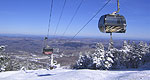
Ski resorts set the scene for the mountains around the town of Killington in winter, though venture to these parts outside of peak season and find also pleasant hiking trails, well-groomed golf greens and a handful of rural attractions.
Location: 6 miles west of the Saco Ranger Station. Turn right off the Kancamagus Highway through the Covered Bridge. The parking lot is on the right and the trailhead is opposite the parking lot. Gradual climb with some steep pitches. Excellent views! A trail guide is available at District offices. Views of Mt. Chocorua and Swift River Valley can be enjoyed from the ledges.
Details
Length:
2.8 miles
Difficulty:
Easy Intermediate
Time:
1 to 1-1/2 hrs
Additional Details:
All trailheads on the Kancamagus Highway require a parking pass. Annual and weekly passes may be obtained at our offices or a local vendor. Daily passes are available at most trailheads.
We offer a compact version of Go-Vermont for mobile users, allowing you to access just the information you need on the road. Of course, you can still use the full version of Go-Vermont on your mobile device just as you can on your desktop.